


Voting District ALMOND, Swain County, North Carolina
About
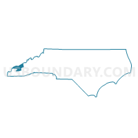
Outline

Summary
| Unique Area Identifier | 641480 |
| Name | Voting District ALMOND |
| County | Swain County |
| State | North Carolina |
| Area (square miles) | 221.32 |
| Land Area (square miles) | 211.57 |
| Water Area (square miles) | 9.75 |
| % of Land Area | 95.59 |
| % of Water Area | 4.41 |
| Latitude of the Internal Point | 35.50375670 |
| Longtitude of the Internal Point | -83.70375540 |
Maps


Graphs
Select a template below for downloading or customizing gragh for Voting District ALMOND, Swain County, North Carolina


Neighbors
Neighoring Voting District (by Name) Neighboring Voting District on the Map
- 11-1 Gatlinburg Amer. Legion Voting District, Sevier County, TN
- Voting District 13, Macon County, NC
- Voting District 14, Macon County, NC
- Voting District 15, Macon County, NC
- Voting District ALARKA, Swain County, NC
- Voting District BC1, Swain County, NC
- Voting District EAST, Graham County, NC
- Lanier Voting District, Blount County, TN
- Voting District STEC, Graham County, NC
- Voting District TAPO, Graham County, NC
- Townsend-County Voting District, Blount County, TN
Top 10 Neighboring County Subdivision (by Population) Neighboring County Subdivision on the Map
- District 7, Blount County, TN (13,268)
- Charleston township, Swain County, NC (11,982)
- District 8, Blount County, TN (11,790)
- Cheoah township, Graham County, NC (6,794)
- District 11, Sevier County, TN (6,524)
- Cowee township, Macon County, NC (2,273)
- Nantahala township, Swain County, NC (1,988)
- Stecoah township, Graham County, NC (1,425)
- Burningtown township, Macon County, NC (894)
- Nantahala township, Macon County, NC (802)
Top 10 Neighboring Unified School District (by Population) Neighboring Unified School District on the Map
- Sevier County School District, TN (89,889)
- Blount County School District, TN (87,224)
- Macon County Schools, NC (33,922)
- Swain County Schools, NC (9,522)
- Graham County Schools, NC (8,861)
Top 10 Neighboring State Legislative District Lower Chamber (by Population) Neighboring State Legislative District Lower Chamber on the Map
- State House District 119, NC (73,640)
- State House District 120, NC (72,565)
- State House District 20, TN (69,827)
- State House District 8, TN (66,531)
Top 10 Neighboring State Legislative District Upper Chamber (by Population) Neighboring State Legislative District Upper Chamber on the Map
Top 10 Neighboring 111th Congressional District (by Population) Neighboring 111th Congressional District on the Map
- Congressional District 2, TN (723,798)
- Congressional District 11, NC (703,606)
- Congressional District 1, TN (684,093)
Top 10 Neighboring Census Tract (by Population) Neighboring Census Tract on the Map
- Census Tract 9702, Macon County, NC (4,090)
- Census Tract 9603.01, Swain County, NC (3,296)
- Census Tract 9202, Graham County, NC (2,869)
- Census Tract 9603.02, Swain County, NC (2,811)
- Census Tract 9701, Macon County, NC (2,684)
- Census Tract 9201, Graham County, NC (2,197)
- Census Tract 115.01, Blount County, TN (1,738)
- Census Tract 9802, Blount County, TN (25)
- Census Tract 9801, Sevier County, TN (1)
- Census Tract 9802, Swain County, NC (0)
Top 10 Neighboring 5-Digit ZIP Code Tabulation Area (by Population) Neighboring 5-Digit ZIP Code Tabulation Area on the Map
- 28734, NC (27,040)
- 28713, NC (8,686)
- 28771, NC (8,558)
- 37738, TN (5,288)
- 37882, TN (2,724)
- 28781, NC (939)
- 28702, NC (366)
- 28733, NC (21)